




Unique Kalash Culture
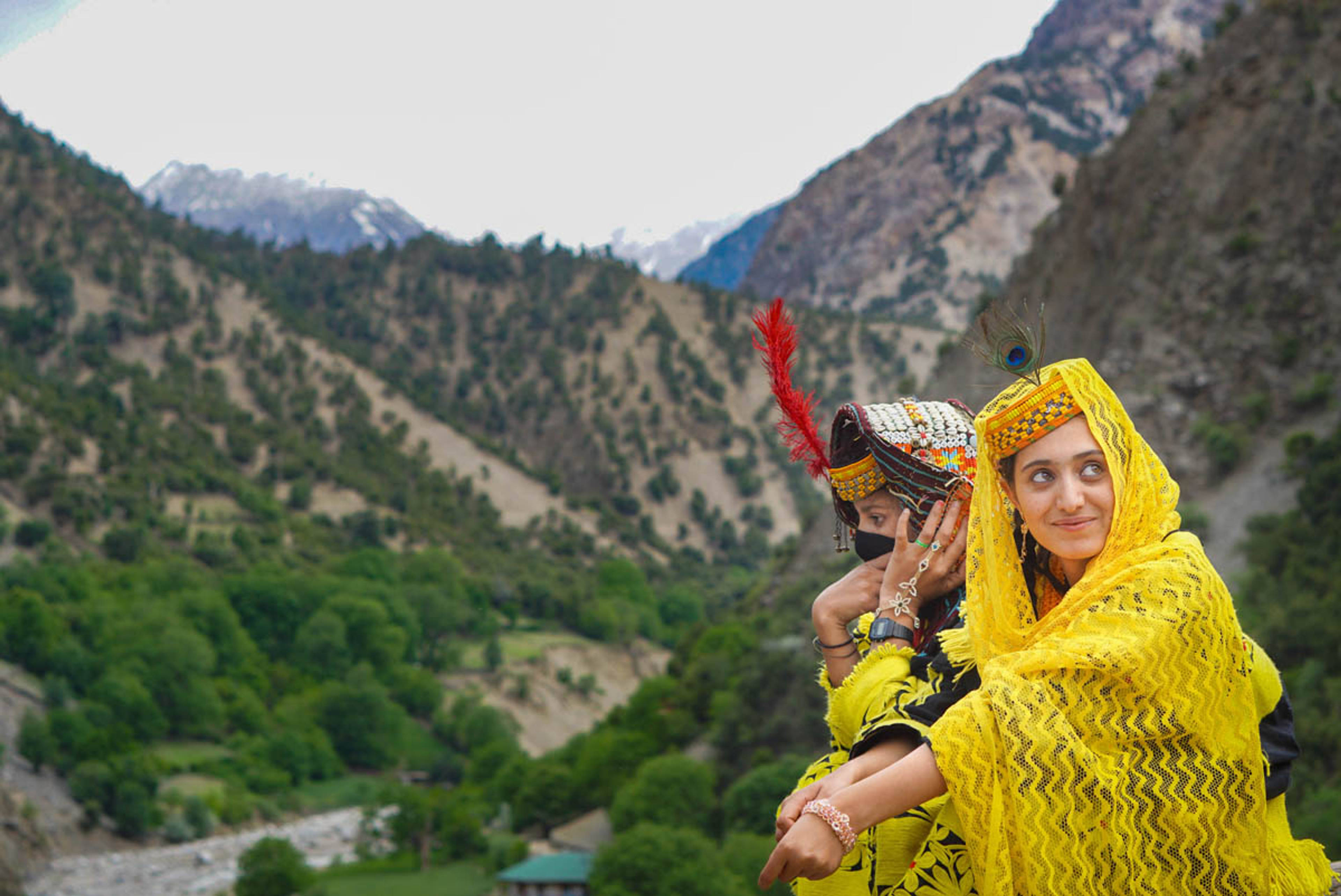
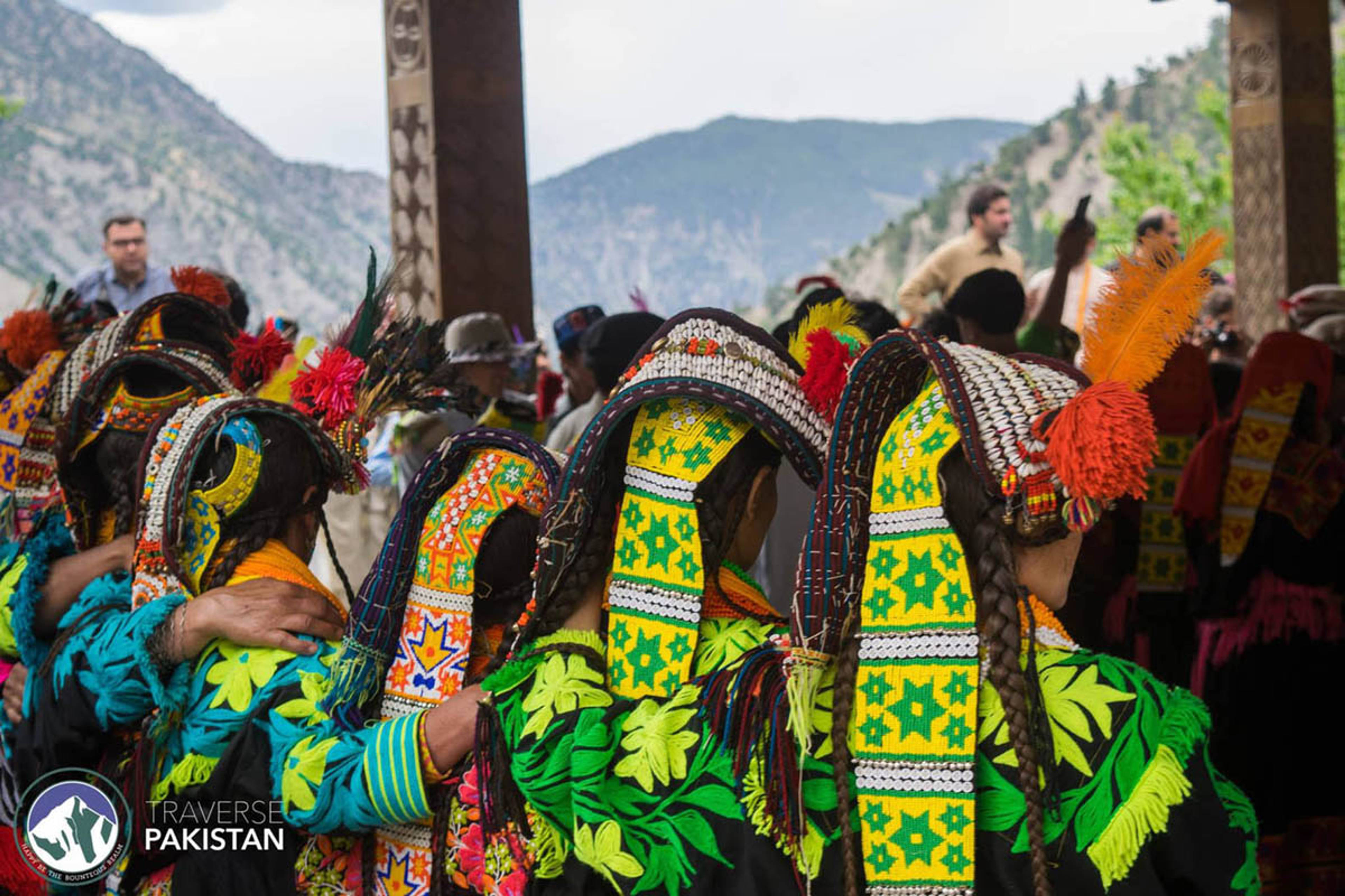
Ancient tribe with their own religion, festivals, and colorful traditions.
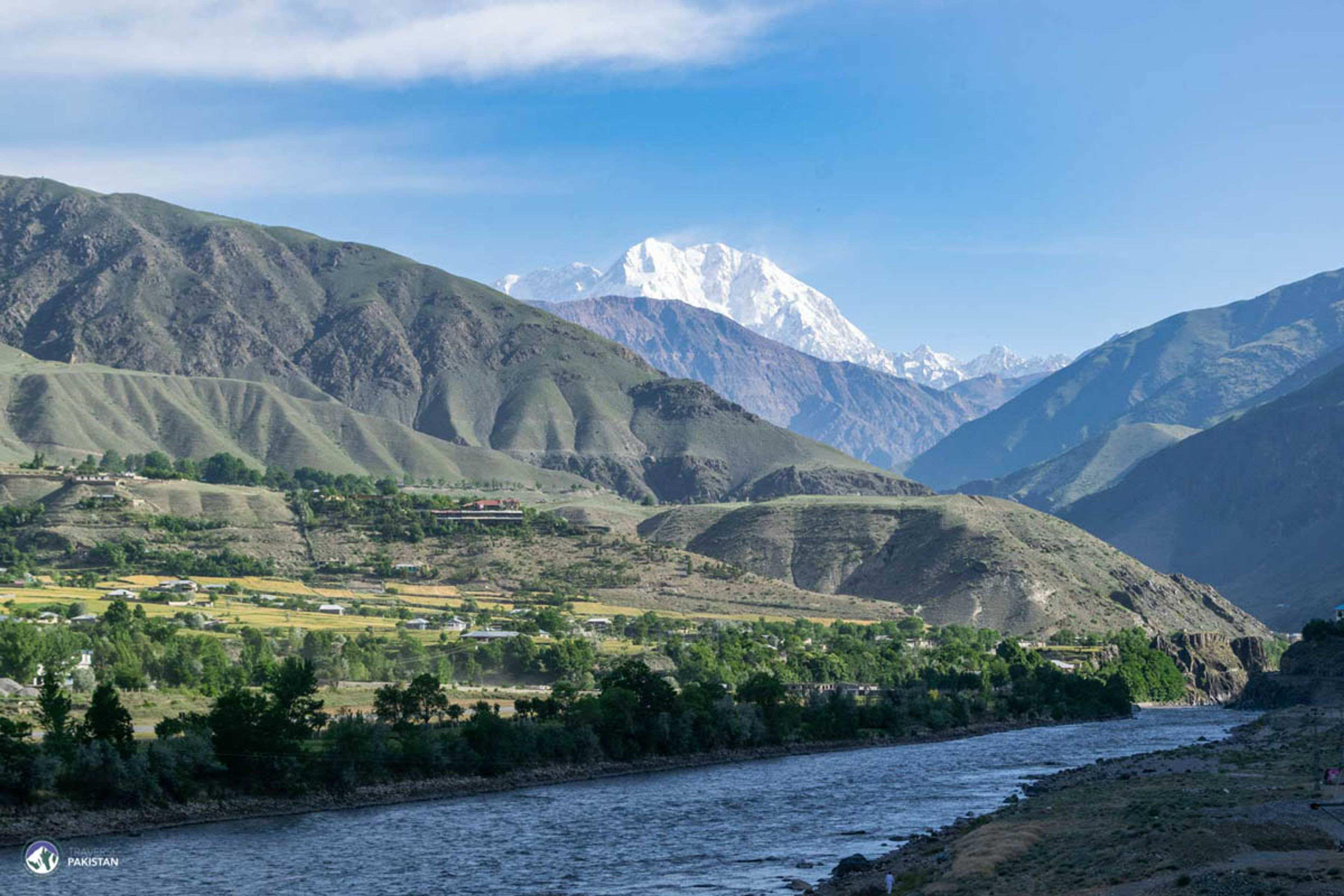
Gateway to Hindukush
Being on the crossroads of Central Asia, China & western side of Indian sub-continent, Chitral has seen many civilisations, from 1st BC it was under Buddhist influence; served as a trade route & passageway for Buddhist pilgrimages to Swat until 8th century AD. Later to be briefly ruled by Tibetan, Kalasha in 11th century AD and finally united as an independent Kingdom by Rais Ruler in 14th AD, overthrown by Katurs in 16th century. From 16th - 18th century Islam flourished in the region due to era of Mughals in sub-continent. In mid 18th century it was under Chinese control but ruled by Katurs by paying tribute to Chinese. After the expansion of Russia in central asia, British supported Katurs to keep Russian influence out of the region. After independence of Pakistan, Chitral was a princely state later to be merged with KPK province in 1969. Local language is Khowar spoken by Kho people who lived originally along Torikho River; resemble their neighbours in north Pamirs and the ancient civilisation along Oxus river. Its a 300km valley separated by Hindukush Mountains from Afghanistan, river draining the valley rises from Borghil as Yarkhun river and after Chitral town is called Kunar River. Tirich Mir 7708m the highest mountain of Hindukush lies in backdrop of Chitral Town, i.e. a base town for expeditions to Tirich Mir, Booni Zom, Koyo Zom and trekking to Karombar Lake, Bashkorgal Lake & Wakhan Corridor.
26 spots to explore

Pagans of Hindukush

Gateway to Kalash

Main Kalash Valley

True Kalash

A Pristine story of Wakhi’s

Under the Shadow of Buni Zom

Gleaming Greys

Birds Eye view of Chitral

Hot Springs

A Surreal Wakhi Settlement

Highest Biologically Active Lake

Highest of Hinduraj

On many Crossroads

The Dry Meadow

Sacred Kalasha

The Orange Fort

Amidst Chinar Trees

The Roof of the World

Amidst the Plateau

On many Crossroads

Highest Polo Ground of World

Scene of Broghil Festival

Edge of the Tree Line

Highest Peak of Hindukush

Prologue of Wilderness

'Yar' 'Khun' meaning 'Friends' 'Home'
7 flexible packages — your dates, your tier
3 hotels & properties
The small, specific reasons travellers keep coming back.
Ancient tribe with their own religion, festivals, and colorful traditions.
The famous spring festival with traditional dance, music, and celebrations.
Dramatic mountain landscapes with snow-capped peaks and rushing rivers.
Spot Pakistan's national animal in the protected Chitral Gol National Park.
Historic Chitral Fort and the ornate Shahi Mosque.
Valleys that remain largely untouched by tourism.
Getting there, what to do, where to stay, and what to eat — the local ground truth.
Chitral is reached by road from Islamabad or Lahore, driving north through Nowshera and Timergara to Lower Dir, then through the 8.6 km Lowari Tunnel that keeps the road open year-round. Total drive is 10 to 12 hours from Islamabad, usually split with a night in Dir or on arrival in Chitral. Before the tunnel was completed, Chitral was cut off from December to April by heavy snow on the old Lowari Pass. Today the route is passable in every season, though winter driving can be slow after fresh snowfall.
There are currently no scheduled commercial flights to Chitral. The route has been discontinued and no operator is running it at the time of writing. If a domestic carrier restarts the service in the future, we will list it here. For now, plan on driving in via Lowari Tunnel.
The three Kalash valleys, Bumburet, Rumbur and Birir, sit an hour south of Chitral town via Ayun and a narrow jeep road. Bumburet is the main and largest valley with most homestays. Rumbur is the most religiously observant and quietest. Birir is the smallest and most traditional. The four annual festivals, Chilam Joshi in May, Uchal in August, Phool in October and Choumus in December, are the best times to see Kalasha music, dance and dress, though the valleys are worth a visit any month.
A jeep track climbs from Chitral town to Chitral Gol National Park, a markhor sanctuary with a birds-eye view over the valley and Tirich Mir. Best visited in the morning when markhor come out to graze. A ranger escort is required and can be arranged through the Wildlife Department office in Chitral.
The Shahi Fort, also called the Orange Fort for its ochre walls, sits on the bank of the Chitral River in the old town. It was the seat of the Katur Mehtars and is still owned by the family. The neighbouring Shahi Mosque, framed by chinar trees, is one of the finest 19th-century mosques in the region.
Garam Chashma, 45 km northwest of Chitral, is a natural sulphur hot-spring village at 1,859 m near the Afghan border. Bathhouses are basic but the mineral water is genuinely therapeutic. A full-day trip from Chitral.
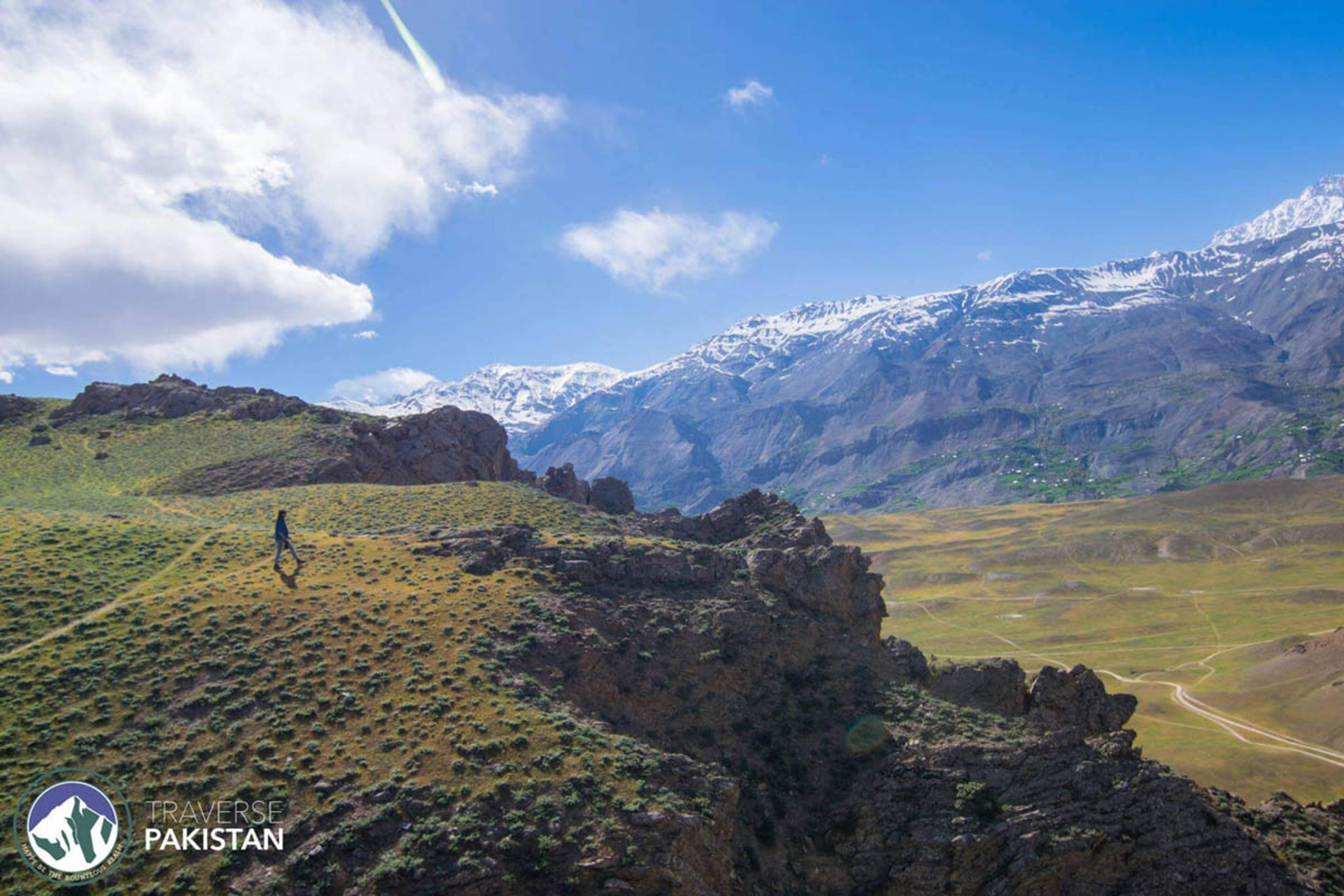
Upper Chitral opens out to the wide Yarkhun and Mastuj valleys, ending at Shandur (3,700 m), the world's highest polo ground and home to the annual Shandur Polo Festival in early July. The Qaqlasht Meadows above Booni are Chitral's answer to Deosai, a wide alpine tableland that turns green in June and gold in September. A trip into Upper Chitral is a 2 to 3 day extension from Chitral town.
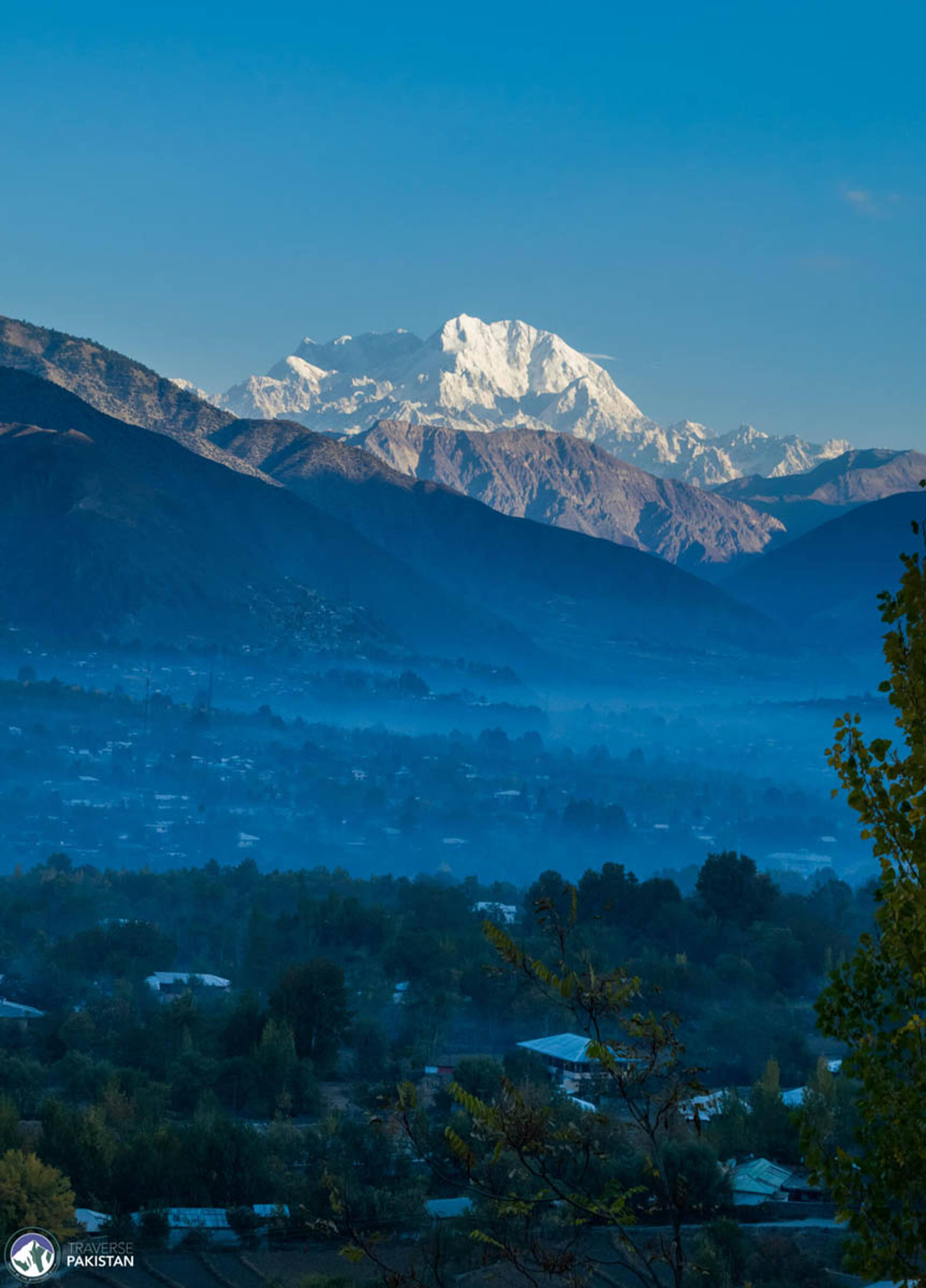
Tirich Mir at 7,708 m is the highest mountain in the Hindukush and dominates the skyline south of Chitral town. Some of the best clear-day views are from Ayun, from the Chitral Gol viewpoint, and from Kalash Bumburet in the late afternoon.
Hindukush Heights is the flagship luxury property, perched on a ridge above town with a wraparound Tirich Mir view, run by a member of the former Chitral royal family. Pamir Riverside Inn is the reliable deluxe option in town, next to the river and walking distance to the fort.
For an early start into Kalash, stay at Ayun Fort Inn in Ayun village, at the mouth of the Kalash valley road. Inside the Kalash valleys themselves, guesthouses are simple family-run homestays. Book through your operator, standards vary and running hot water is rare.
Chitral speaks Khowar, an Indo-Aryan language of the Dardic group, distinct from Pashto and unrelated to Balti. The Kho people trace their origins to the Pamir corridor and their music, most famously the sitar-and-daf ensemble, is closer to Central Asian than South Asian styles. The signature dish is chapshuro, a hot meat-filled flatbread cooked on a griddle. The Chitrali cap, or pakol, is the wool cap that has become the visual signature of the northwest. Kalasha culture is entirely distinct from the Muslim Kho majority, with its own language, religion, festivals and dress that make the valley visits the cultural highlight of any Chitral trip.
Mid-March – Mid-April
Best timeApricot and cherry blossoms carpet the orchards along the Chitral River — the valley's most photographed weeks.
Mid-April – Mid-October
Best timeLong light and warm 15–28°C days — clear Tirich Mir views and full access to Kalash valleys, Garam Chashma and Bumburet.
Mid-October – Mid-November
Best timePoplars, apricot and cherry trees turn yellow, orange and merlot red — dry, still air and sharp peak lines.
Mid-November – Mid-March
ShoulderLowari Tunnel keeps the road open year-round — Chitral snow-dressed, warm homestays, upper valleys and Shandur side closed.